Kasargad Fm
Type Locality and Naming
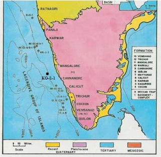
SUBSURFACE: The type section is in the Well KG-1-1, Interval is 2369-2957m and thickness is 588m. [Original Publication: Mathur, R.B., Sreekantswamy, H.N., Ananthakrishna, K., Srivatsava, U.C., Biswas, S.K., Krishna, A., Bhosale, J.S., Rao, K.V.N., Satyanarayana, Y., Rathod, G.D., Bose, P.K., and Karwal, S. 1993: Lithostratigraphy of Indian Petroliferous Basins, Document VI, Kerala Konkan Basin, KDMIPE, ONGC Publication, pp 1-33.]
[Figure 1: Location map of type section (after J.Mishra in Raju and Misra, 2009)]
Lithology and Thickness
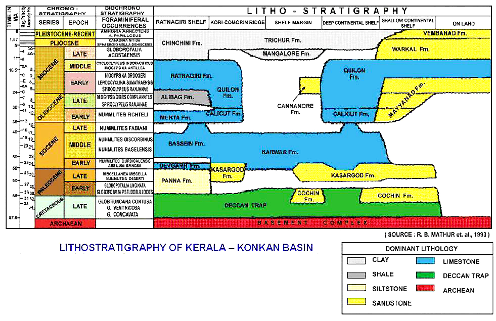
Clayey sandstone. This formation consists of predominately grey, medium- and fine-grained sandstone with thin beds of grey to dark grey clay and Limestone towards the top part. In CH-1-1, Kasargad Fm consists of argillaceous limestone, sandstone and shales in the upper part two thin basaltic flows were observed in the basal part of this formation in CH-1-1.
[Figure 2: Lithostratigraphy of Kerala-Konkan Basin (from dghindia.gov.in)]
Relationships and Distribution
Lower contact
Lower boundary is unconformable with either Cochin Fm or Deccan Traps Fm.
Upper contact
Upper boundary is gradation with Karwar Fm.
Regional extent
GeoJSON
Fossils
Nummulites globules, Assilina placentula, Miscellania miscella, ranikothalia sp., and Lockhartia hunti
Age
Depositional setting
Inner shelf.
Additional Information

